| Essential Archez Information | Archez Bars & Restaurants |
Archez Photos |
Archez History
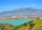
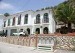 The small area of the municipality of Archez –only 5 square kilometres- confers an almost domestic character upon this territory that is reaffirmed by the landscape itself, which except for the nearby Tejeda and Almijara mountain ranges seems to shun the spectacular geographic features that are the norm in La Axarquía. The valley of the river that bears this municipality’s name and that later takes the name Algarrobo forms a landscape of level-topped heights with no great contrasts of elevation. Some hills near the river change into terraces that permit the cultivation of fruit and vegetables, in contrast to the classic native low brush, in this case- of all this territory.
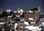
The Tejeda and Almijara mountain ranges provide Archez with an abundance of water that feeds into several tributary streams to increase the river’s flow, and after the rains several ponds remain that are often visited by people familiar with the place.This locality is included in the Moorish Route not only because it is a necessary step to the other villages that make up this route but also because it has one of the best examples of this kind of art in the province of Málaga: the minaret-tower of the La Encarnación church. It is strange, therefore, that along with such a significant monument there exists no documentation that would reveal the events that occurred in this village centuries ago.
Despite the lack of historical documentation the existence of a Moorish monument of the first magnitude predisposes one to believe that Archez must have had a certain importance in the Muslim era, and considering its geographic setting it is also not hard to imagine the part that it may have played in the Moorish rebellion in the La Axarquía region.It is considered certain that the village had its origin in a Moorish farm community, and it is indeed documented that it was conquered by Christian troops in 1487, along with the settlements around it. Archez became a part of the lordly estates of Don Diego Fernández de Córdoba, a lordship that later passed into the hands of the Marquise of Comares.
Aside from this historical footnote, no other chronicle sheds light on the history of Archez until in the nineteenth century it is written about the village, that at that time, “Looms, for white and blue linen, were operating (colours very popular with the Muslims, curiously enough), as were three distilleries, two flour mills and four oil mills,” all of which indicates remarkable economic activity for a place that must never have had many inhabitants
 |
 |
| Surface Area: | 5 square kilometres |
| Population: | about 350 |
| What the natives are called: | Archeros |
| Monuments: | minaret-tower of the Nuestra Señora de la Encarnación church. |
| Geographical Location: | in the central part of the La Axarquía region, 21 kilometres from Vélez Málaga and 435 metres above sea level. The average annual rainfall is 670 litres per square metre and the average temperature is 17º C. |
| Tourist Information: | Town Hall, Calle Clara Campoamor, 1 (29753). |
| Telephone: | 952 553 159; Fax: 952 553 019 |


