 |
 |
 |
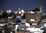
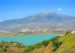
 The traveller’s first impression as he approaches this village is that he is entering an enormous, well-planned and well-tended orchard where the citrus trees-oranges and lemons-join their perennial greenery to that of the subtropical fruits that have been more recently introduced in the region. The terraces of these crops climb to the nearest hills, which are devoid of vegetation on their highest levels.
The locality borders the river of the same name, Benamargosa. This stream is called the River La Cueva from its source to the village and a few kilometres downstream empties into the River Vélez after shaping a narrow valley that is the dominant feature of the area’s terrain.
Since there is absolutely no documentation on which to depend in outlining the history of this village before the arrival of the Arabs, one must start with the fact that the thirteenth century Muslim botanist Ibn Beithar was the first to introduce citrus cultivation in this region. As to the name of the village, it is accepted that it derives from Ben Ha-Maruxa, but this is more a deduction than a certainty.
The village’s name begins to appear in some chronicles in the late fifteenth century. From them we learn that in that era the locality, like many other farm communities, belonged to the royal burgh of Comares, and also that its inhabitants at first did not take part in the Moorish uprising but would eventually join the revolt in 1569, with the result that in the following year they were driven from their lands, leaving them virtually uninhabited. Its later development was thus directly subordinated to Vélez Málaga.
In 1810 the mayor of the royal burgh, like that of a number of other mayors, was obliged to sign an oath of allegiance to José Napoleón I, King of Spain. The appearance of the phylloxera pest sapped the economy of the village to the point that many of its residents had to leave for other areas in search of a better life.
 |
 |
 |
| Surface Area: | 12.1 square kilometres |
| Population: | about 1,500 |
| What the natives are called: | Benamargoseños |
| Monuments: | La Encarnación church and the cemetery hermitage |
| Geographical Location: | in the La Axarquía region 11 kilometres from Vélez Málaga and 46 from the provincial capital. The urban centre is about 100 metres above sea level. The municipality records an average annual rainfall of 520 litres per square metre and the average temperature is 17º C. |
| Tourist Information: | Town Hall, Plaza del Ayuntamiento (29718) |
| Telephone: | 952 517 002; Fax: 952 517 271 |


