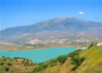
Every so often, when my group of friends has a few too many wines with dinner, we make grand plans about places we are going to visit and things we are going to do. The place and activity changes but one thing always stays the same – we never actually do any of them (the exception being the Malaga 10k a few years ago). The activity that is mentioned the most often is climbing Maroma – that fantastic & impressive mountain that sits behind Competa. Despite the 5 couples in question being active and up for travelling not single one of us has been to the top of Maroma in 8 years.
Maroma is the highest peak in Malaga province at 2,066m (6,778ft). For comparison Ben Nevis, the highest mountain in the British Isles, is only 1,344m (or 4,409ft) high and Scafell Pike in the Lake District, the highest in England, is 978m (3,290ft).
My husband was 40 this October and we decided that it would be fitting to mark the day by finally getting to the summit. So we agreed with our group of friends that Sunday the 13th of October 2013 would be the day we attempted it. Now all I needed to do was figure out how to get 13 people and 5 dogs safely to the top and back!
Maroma means rope and refers to the 30m sections of rope used to descend a natural well shaft to an ancient ice house near the summit.
I did a bit of research in walking books and on the internet which revealed that there were several different routes each with their own start point and level of difficulty.
1.El Robledal. This walk is 4 hours up and 3.5 down and it starts from the Granada side of the mountain. It involves a climb of 1,200m over a 23km route and it is moderate to difficult.
2.Alcaucin / El Alcazar. The estimates for this walk are 7 hours in total with a climb of 1,200m over 23km. It starts from a picnic area above Alcaucin. This is supposed to be easier than El Robledal or the Canillas de Aceituno walk.
3.Canillas de Aceituno. This is reported as being the hardest route of all due to the vertical climb (1,500m) but the most spectacular. It is an 8 hour hike and only for the fit.
4.Sedella. There are paths from the back of Sedella up to the summit. The distance is 16.9km with a climb of 1,141m. They are challenging paths due to the steep vertical sections.
5.Llanadas de Sedlla. This is the easiest and shortest route taking about 5 hours to cover 6 miles. You need a 4 x 4 or car with high ground clearance to reach the start point. You can either arrange a permit and use the track running along the Fogarate fire break or take the track from the Canillas de Albaida fabrica that heads up towards Jatar for which no permit is necessary.
I found the wikiloc.com website very useful for planning the walk. On it walkers share their walking routes with descriptions and detailed GPS coordinates. You can load these into Google Earth and your phone enabling you to check your actual position against the route while you are on the walk. There are other phone apps that do a similar job like Runkeeper, Everytrail, AllTrails and MapMyHike. You can view other people’s routes online, download them and save your own walks.
We chose to attempt walk 5 so we had enough time to get cleaned up and party at El Pilon afterwards. We all met in the Competa car park at 9.30am. Most had come prepared with walking gear and lots of water, some had not (yes Andy I am talking about you). Seven of us and two dogs piled into the Peter Pan van and the rest of filled up two 4x4s.
Peter Pan had got a permit for us so it was an easy drive up to Fogarate and then up the fire break track. The drive is passable by car most of the way – there are just three or four places where water crosses the track where high ground clearance is required. An hour later and we were all stood on the Llanadas de Sedella taking in the fantastic views to Africa one side and inland to Granada and the Sierra Nevada’s on the other. If you aren’t fit or mobile enough to attempt the walk it is still worth getting to this point in a car just to walk along the ridge and have a picnic. The views are stunning; perfect blue sky, rolling hills below and a carpet of tiny purple crocuses – magic!
.
Then you continue along a flat track which eventually passes a small grove of trees and another spring . You then climb up through a section of loose rock and low scrub – the path is not well marked here but as long as you head up and left along the ridge you will fine. By the way, our advice is don’t be tempted to walk on the scrub and low bushes – stick to the exposed rock. Right by our feet a small, nasty looking black snake slithered out of some of the scrub. We are not certain it was dangerous but venomous snakes are found in this area at this altitude so be careful.
This walk is relatively easy and it’s straightforward to get and keep your bearings. However this is only true in good visibility. Due to the height of the walk, thick cloud can form and move quickly. It would be hard to keep your bearings in cloud and there are some dangerous drop offs. So don’t attempt this walk if it is not clear. If cloud does start to form give serious consideration to quickly returning to your start point.
Then there is a potentially scary bit. There is a 10m section that is a few meters wide, there is a non-dangerous slope dropping off to one side and a vertical dangerous drop the other. Most of our group found this section fine but the people who were afraid of heights found it very challenging indeed. This would be no fun at all without good visibility. Having said that the views from this section are some of the most dramatic of the whole walk so make sure you take some photos.
The final section is a slow climb over loose rock. The path disappears here but you just head up and along the ridge until you see a stone tower – head for this as it marks the summit. From here you have magnificent 360 degree views of the Granada and Malaga provinces, the sea and Africa. It is definitely worth the effort.
Take plenty of water. My husband, dog and I easily got through over 4 litres between us. There are a couple of springs on the way but I have no idea if the water is clean and we did not risk drinking from them. The temperatures are 5-7 degrees cooler at the top than in Competa and wind chill can greatly increase this difference. If you are attempting the walk in the Winter make sure you take warm clothing – gloves and hats are particularly effective if it’s windy.
We washed down our butties with some cava which Ali had carried all the way to the top for us. The brave used the loosely attached metal rings to climb to the top of the tower and we all took loads of photos. Margo was the only one bright enough to have brought sun screen so we all passed that round in an attempt at some damage limitation. Then we packed up and headed back. Even though it’s downhill it takes just as long to walk back as it did to get there. Walking sticks definitely help on the way back as there is a lot of loose rock.
Despite all of us taking litres of water with us, by the time we are back at the cars we are all parched and I make a fortune auctioning off my 6 pack of juice boxes! Then we head back to Competa to the nearest bar, loo and a round or three of shandies!
This really is a fantastic walk to do. If you are nervous about attempting it or can’t get to the start point consider speaking to one of the walking or adventure companies operating from our village. All can offer at least one route up Maroma and they can provide a vehicle, driver and/or guide.
The next walk for me will be Lucero (1,780m or 5,840ft) which is the shark toothed peak at the back of the Lost Village and Nerja. I shall start planning it with my friends now so please read the grapevine in 2021 by which time we might have got round to it!


