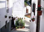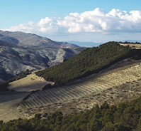
Over the mountains from Cómpeta the historic town of Alhama de Granada nestles in a valley and is a great base for exploring the great outdoors. Only an hour from the coast, the scenery changes dramatically from the high peaks of the Sierras Almijaras, Tejeda and Alhama to a more rolling countryside. The peaks of El Fuerte (Frigiliana) and El Lucero (Cómpeta) can be seen in the distance as you approach Alhama de Granada, and the passes of Puerto de Frigiliana and Puerto de Cómpeta loom in the background ready to be walked and explored. There is, however, a lot to see near the town itself. For the culture and history buffs, the routes of the romantic writer Washington Irving passes through the town, and the Arab traveller and writer Ibn Batuta. The effects of earthquake of 1884 can be clearly seen in Alhama de Granada – the book “Los Terremotos de 1884, Arenas del Rey y Seco de Lucena” by Andrés García Maldonado documents its devastating effects on Andalucia. It was the same earthquake which rocked Cómpeta and damaged the church of Nuestra Señora de la Asunción in Plaza Almijara. The tourist office offers tours at 12 noon every Tuesday, Thursday and Saturday.
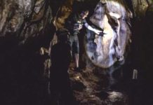
As to the geology, the gorge of the Tajos is reminiscent of the Grand Canyon on a smaller scale, and the walk through the gorge to the local beauty spot El Ventorro is well worth a visit. Starting in Alhama de Granada from behind the Nunnery Church Nuestra Señora del Carmen (16th 18th century) and the tourist office, follow the track down the steps called the “Cuesta del Carmen” down to the river Alhama. Continue along the path which leads to the Molinos de la
Acequia Alta Mills, and the Camino de los Angeles. This route passes through the Tajos and is part of the GR-7 (Gran Recorrido No. 7) – just one of the network of long distance paths in Andalucia). At the time of writing (early March 2008) the almond blossom is still in full flower – the town is at over 1000m whilst Cómpeta is at 636m so spring comes a little later at that altitude. At this time of year, the chasm is full of flowers, wooded glades of deciduous trees and birds nesting on the cliffs.
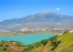
Continue along the chasm with Puerto de Cómpeta in the distance – this is known as the Pantaneta route and there is an interpretive board about the geology of the area (in English and Spanish) which explains the activity of the European and Iberian tectonic plates over the years. Moving on, you will pass the shrine of Los Angeles – have a look inside – you will be surprised at how it has been decorated. After another .5km you will come to a crossing over River Alhama on the left over a wooden bridge. This is a favourite picnic spot for locals and visitors alike. Cross the river and continue along the track, on the left you will see the remains of a hydroelectric system. Eventually you will come to the Alhama – Jatar road – cross the road, and turn left (keeping on the path and take care as traffic goes very fast on this stretch). To the right is a road bridge and take a moment to have a look at the dam and the lake. Continue then to the left, and pass a secluded house with conifer trees outside, and when you come to the clearing you will see El Ventorro, a great place to stop for a drink or a meal (book up at weekends, especially for lunch). El Pato Loco (the Crazy Duck!) is next door and has a swimming pool and more outside space. Across from both establishments is the lake with a wide variety of ducks, coots and other water fowl. There is an information board with pictures explaining the best time to see which type of bird. If you stay overnight in this idyllic spot you will hear foxes barking in the dark. Inside El Ventorro there are magnificent paintings of the countryside covered in snow. It is 10km to Jatar and the turquoise waters of Lake Bermajales.
There are many walking tracks in this area, and the Ruta de los Angeles goes right through to the hot springs (balnearios) which is definitely worth a visit. From the town it takes about half an hour, and again the going is good underfoot.
It is also possible to climb Maroma (2066m) from the Alhama side, and through the Puerto de Cómpeta and Puerto de Frigiliana. We can provide information on accommodation in the Alhama de Granada area – contact us for a quotation. More information from http://www.spain.iberacal.com.
Walking Group
Alhama de Granada: Terry Mottershead – http://www.alhambrarambler.com
Getting there:
Bus:
Alhama – Málaga: 16:30 via Torre del Mar
Málaga – Alhama: 09:00 via Torre del Mar
Car:
From Cómpeta – drive to Canillas de Albaida and turn left past Bar Cerezo. By the shrine, turn right and follow the zig zag road past Finca Cerillo and at the end of the road, turn left (the right hand fork takes you to Fogarate) then right on to the tarmac road towards Salares. Follow the road through Salares, Sedella and Canillas de Aceituno, using the by passes for each village. After passing through Canillas de Aceituno you will be able to see Lake Viñuela. At the end of the road turn right and pass through La Viñuela (the little vine). You will join the Velez Málaga – Zafarraya road – turn right and head for the pass.
Follow the A335 / A340 from Velez Málaga to the pass at Zafarraya, then bear right after passing through the village. It is signposted to Alhama de Granada.
Tourist office:
Paseo Montes Jovellar s/n
Tel. y fax 958 360 686
www.turismodealhama.org
Email: turismo@alhama.org
Caledonian Iberian ConeXions S.L.


